Major Winter Storm Targets South And East US With Potentially Catastrophic Impact
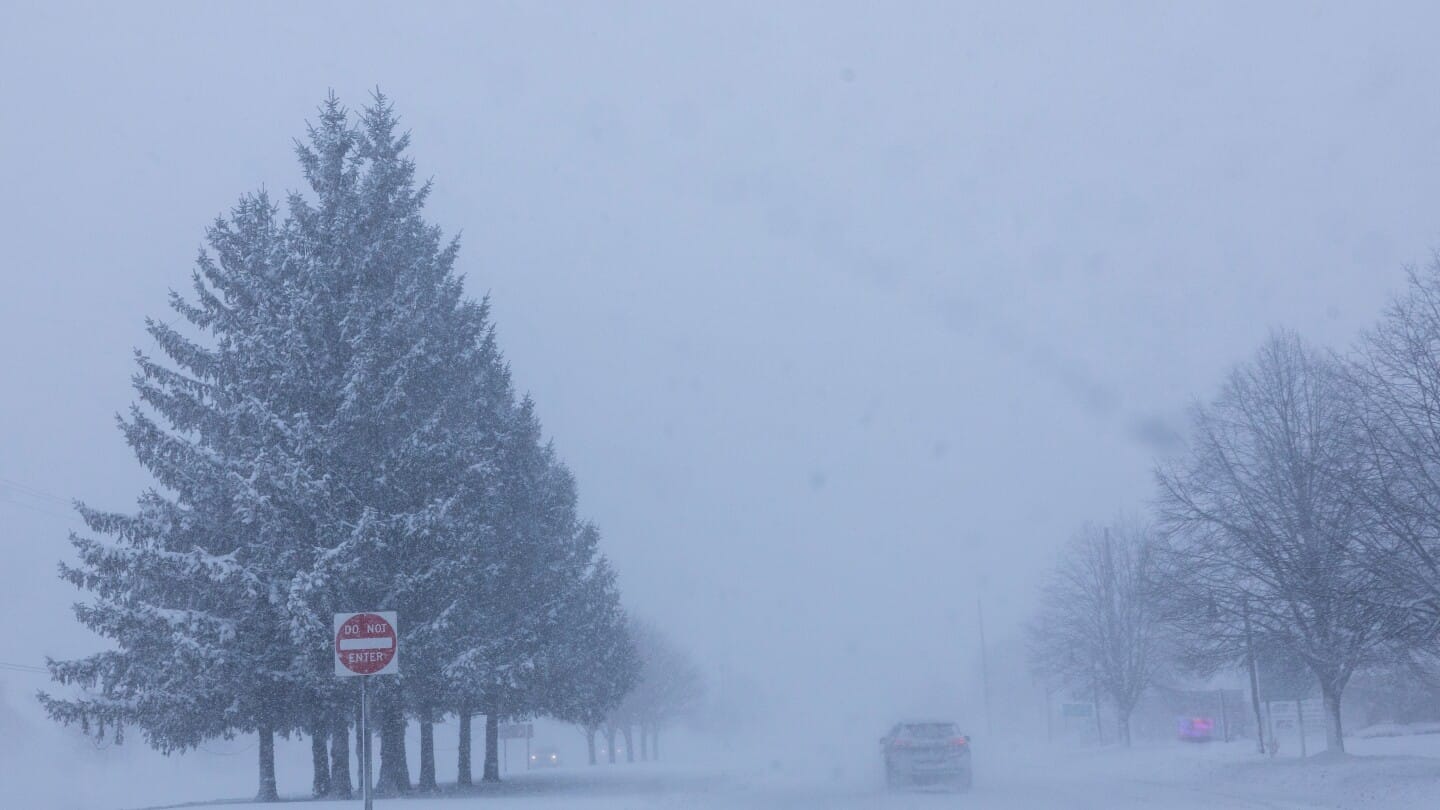
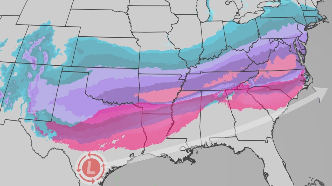
Forecasters are warning of a significant and potentially catastrophic winter storm set to impact a large portion of the United States, stretching from Texas through the Carolinas and up the East Coast. The storm system, expected to intensify beginning Friday and extending into the weekend, poses risks of heavy snow, but primarily dangerous ice accumulation, particularly in regions that are unaccustomed to such severe cold-weather events.
A winter storm watch has been issued for millions of residents, alerting them to the threat of widespread travel disruption and potential power outages. While parts of the East Coast may see scattered snow tomorrow, the primary threat will materialize over the weekend as the storm strengthens and moves across key population centers.
The Threat of Freezing Rain and Ice Accumulation
The core concern for forecasters, particularly in the Southern states, is freezing rain and sleet. Unlike snowfall, which is generally easier to manage and remove, ice accumulation presents unique and potentially devastating hazards. Freezing rain occurs when snow melts in a warm layer of air aloft and then refreezes upon contact with a surface that is below freezing temperature. Even small accumulations of ice can create extremely dangerous conditions.
Ice accumulation as little as one-quarter inch (0.6 cm) can weigh down tree branches and power lines, leading to widespread power outages. As the ice accumulation increases, the weight on infrastructure becomes potentially catastrophic, leading to extensive damage to power grids that can take days or even weeks to repair. The warning of a “potentially catastrophic” storm highlights the severity of this specific risk for the region.
The southern United States, specifically the areas from central Texas through Georgia and the Carolinas, is often less prepared for ice storms compared to states in the Northeast or Midwest. Infrastructure in these areas, including power transmission systems and transportation networks, are typically not built to withstand the heavy ice loads that northern regions regularly face. The lack of extensive de-icing equipment and road crews trained in handling heavy ice further exacerbates the vulnerability.
Regional Impact and Preparedness Measures
The storm’s trajectory suggests that key metropolitan areas in the Southeast, including Atlanta, Georgia, and Charlotte, North Carolina, could be hit hard by the system. These cities serve as major hubs for air travel and ground transportation, and a significant disruption could have far-reaching economic consequences. A small amount of snow and ice in these areas can bring local economies to a standstill and snarl supply chains throughout the region.
The winter storm potential is also being closely monitored in areas further north. While the initial forecast points to the South as the primary target for severe ice, a mix of precipitation including snow and rain is possible further up the Eastern Seaboard. The change in temperatures over the coming days will be crucial in determining the exact track and impact of the storm in different regions.
In response to the severe warnings, officials are urging residents in affected areas to prepare for potential power outages and difficult travel conditions. It is essential for residents to secure emergency supplies, including food, water, flashlights, batteries, and blankets, and to have a plan for staying warm if the power grid fails. People are also strongly advised to avoid non-essential travel during the storm, as icy roads dramatically increase the risk of accidents.
Understanding Winter Storms: The Science Behind the Threat
Winter storms are complex meteorological events that involve the collision of different air masses. This particular storm system is likely driven by cold, Arctic air moving south and colliding with a moisture-rich air mass originating from the Gulf of Mexico. The precise temperature structure in the atmosphere dictates the type of precipitation that falls at the surface.
If the entire column of air from the cloud to the ground is below freezing, snow results. If there is a warm layer aloft (above freezing) and a cold layer below (at or near freezing), the precipitation can transition between sleet (ice pellets that bounce on contact) and freezing rain (liquid water that freezes on surfaces). The transition between these types of precipitation can be narrow, making forecasting particularly challenging for southern regions near the boundary between the cold air and warmer air.
When the surface temperature is below freezing, but a layer of warm air above prevents snow from reaching the ground, freezing rain forms. Sleet, on the other hand, occurs when the warm layer is thinner, allowing the melted snow to refreeze into ice pellets before reaching the surface. Freezing rain is generally considered more destructive than sleet because it creates a solid coating of ice that adheres to surfaces and adds significant weight.
Historical Context: The Impact of Past Southern Ice Storms
The warnings of a potentially catastrophic storm recall past significant winter events in the Southern United States. Major ice storms have historically proven more damaging to southern infrastructure than heavy snowfall in northern states. In February 2014, for example, a severe ice storm brought Atlanta to a standstill, trapping thousands of commuters on highways for hours. The city, and much of the region, struggled to recover due to a lack of resources dedicated to winter weather management.
Another prominent example occurred in January 2000, when a massive ice storm struck the Southeast, leaving hundreds of thousands without power in Georgia and the Carolinas. These events serve as reminders of the disproportionate impact that seemingly moderate ice accumulations can have when a region’s infrastructure is not prepared to handle them effectively.
The vulnerability of power lines in the South is especially pronounced due to the density of deciduous trees in the region. When ice accumulates on branches, the trees become brittle and break easily, falling onto power lines. This phenomenon causes more widespread power outages than in regions where evergreens are more common and infrastructure is hardened against ice. The combination of vulnerable infrastructure and susceptible natural environment increases the stakes for the current storm.
Beyond Travel: Economic Implications and Supply Chains
Beyond personal safety concerns, a winter storm of this magnitude in the South has significant economic implications. The closure of major airports, such as Hartsfield-Jackson Atlanta International Airport, one of the busiest in the world, can cascade into a global disruption of air travel. Furthermore, disruptions to ground transportation on key interstate highways like I-95 and I-20 can hinder supply chains for a variety of industries, including manufacturing, retail, and agriculture.
Businesses rely on just-in-time logistics, meaning a delay of even a few hours can disrupt production schedules across the country. A major storm in the Southeast, a growing manufacturing hub, could have a substantial ripple effect throughout the national economy. The warnings issued by forecasters provide an opportunity for businesses to prepare for these disruptions by adjusting inventory and transportation schedules in advance.
The potential for a “potentially catastrophic” storm highlights the need for continued investment in resilient infrastructure and robust preparedness plans in regions that are increasingly seeing severe weather events due to changing climate patterns. The forecast serves as a critical call to action for both residents and local authorities to prioritize safety and prepare for significant impacts that could last well beyond the storm itself.